bharatlas
India's open geo data: state to village boundaries, city wards, forests, hospitals, rivers and more. Find what's at any point and query any layer. Hosted at https://bharatlas.com/mcp, no key.
Servidor MCP hospedado
npx add-mcp 'https://bharatlas.com/mcp'Instala no Claude Code, Codex, Cursor e outros
Documentação
bharatlas
India's open geo data in one place: browse, filter and download curated layers, look up your ward, share your own maps, and query it all from an AI assistant.










Live: bharatlas.com · map authoring at collect.bharatlas.com · API docs at bharatlas.com/docs · MCP setup at bharatlas.com/mcp
Contents
- What it does
- Features
- Layers and sources
- Downloads and formats
- Use it from an AI assistant (MCP)
- API
- Data principles and attribution
- Architecture
- Project layout
- Development
- Deploy
- Contributing
- Security
- Licence
- Credits
What it does
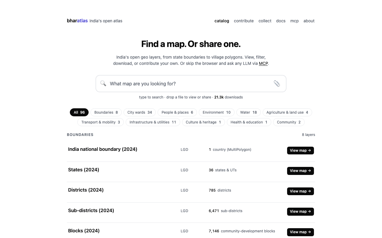
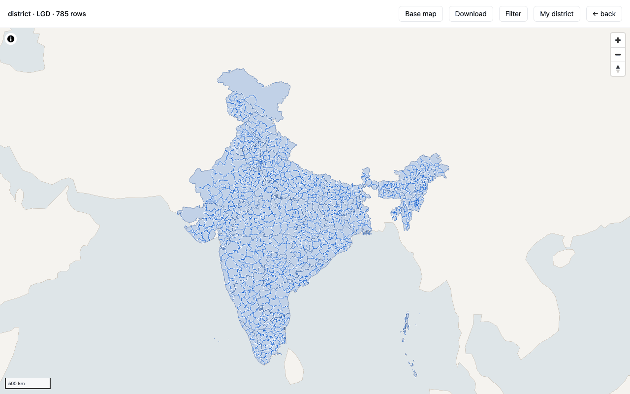
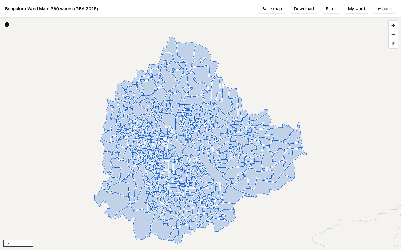
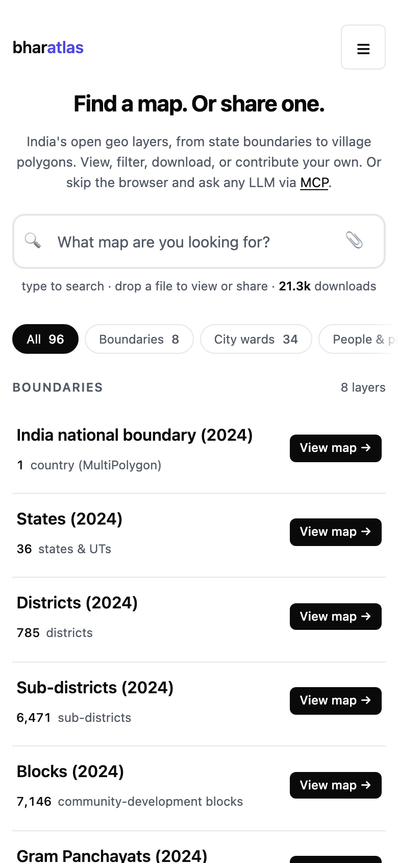
bharatlas is a catalog of India's open geo layers, from the national boundary down to villages and city wards, with water, environment, infrastructure, transport, health and agriculture layers alongside. Every layer opens on a map, can be filtered and sliced, and downloads whole in several formats. Anyone can add a layer under an open licence, or gather points from the field with collect. The same data is available through a REST API and an MCP server for LLMs. Reading needs no account and no API key.
| Layer view | City ward map | Mobile |
|---|---|---|
 |  |  |
Features
- Catalog: India national boundary, then state, district, subdistrict, block, gram panchayat and village (LGD), with cross-source alternates (SOI, Bhuvan, geoBoundaries, PMGSY) shown as "also: ..." on each card. City wards, electoral constituencies, wildlife areas, eco-sensitive zones, rivers, canals, groundwater, floods, seismic zones, highways, hospitals, pincodes and more.
- View (
/view/<id>): each layer on a MapLibre map with a base map choice, filter and download, and its own share card. - Filter and slice: facets, ranges and typeahead search built from each layer's schema. Export the slice in any download format.
- My ward / My district: on ward and admin layers, a locate button finds the polygon you are standing in (or a shared
?at=point) and lets you zoom to it or share it. - Preview (
/preview): drop a GeoJSON, KML, KMZ, GPX, TCX or Parquet file to render and validate it in the browser. Nothing is uploaded until you choose Publish. - Community layers (
/c/<id>): published submissions, reviewed by a curator before they appear, each with its source, licence and a "useful" vote. - Embed (
/embed/<id>): an iframe of any map, plus PNG export. - Collect (collect.bharatlas.com): design a small form, share a link, and anyone with it adds points, lines and areas from their phone with no account. Review contributions, then download them or publish to the catalog. Links are token-scoped (view, collect, admin).
- API (
/api/v1): list, schema, query, filter,group_bywith per-group sums, locate (point-in-polygon across layers) and nearby (features within a radius). - MCP server (
bharatlas-mcp): 17 tools for LLMs, for reading the catalog and for authoring collect maps. Also shipped as a Claude Code plugin.
Layers and sources
The live catalog lists 109 layers (GET /api/v1/layers, checked 12 November 2026), plus community submissions (GET /api/v1/submissions). Counts by category, from GET /api/v1/categories:
| Category | Layers | Examples |
|---|---|---|
| Boundaries | 20 | lgd_states to lgd_villages; SOI, Bhuvan and geoBoundaries alternates; PMGSY blocks and habitations |
| City wards | 34 | wards_bengaluru_gba, wards_chennai, wards_mumbai, wards_delhi; BDA jurisdiction and layouts |
| Water | 19 | WRIS rivers, canals, basins, dams, reservoirs; CGWB aquifers and groundwater extraction; India Flood Inventory; NDEM floods 1998-2022 |
| Infrastructure and utilities | 12 | pincode polygons, VEDAS power plants and transmission lines, Overture places |
| Environment | 10 | wildlife sanctuaries and national parks, eco-sensitive zones, SOI forests, seismic zones, landslides, earthquakes, cyclone tracks |
| People and places | 6 | parliament and assembly constituencies, high courts, NGT zones, NCLT benches |
| Agriculture and land use | 4 | agro-ecological and agro-climatic zones, soil health, land use by block |
| Transport and mobility | 3 | highways, airports, PMGSY roads |
| Health and education | 1 | NIC HealthGIS health facilities |
The full catalog, with each layer's source, licence, row count, freshness and download sizes, lives in catalog.json and on bharatlas.com. Known data caveats (name spellings across sources, coverage gaps, polygon precision) are on /about#caveats.
Downloads and formats
Each layer downloads whole from its card or its view page:
| Format | Use it for | Layers that have it |
|---|---|---|
| Parquet (GeoParquet) | analysis in DuckDB, pandas, GeoPandas, QGIS | 109 of 109 |
| PMTiles | web maps, including the map view itself | 108 of 109 |
| GeoJSON | web tools, most GIS software | 108 of 109 |
| KML | Google Earth | 104 of 109 |
| Shapefile (zipped) | desktop GIS | 103 of 109 |
The files are served from Cloudflare R2. GET /api/v1/layers/<id> returns the URL and size of each format the layer has. A filtered slice exports from the Filter panel in the same formats. Very large layers (gram panchayats, villages) are best sliced by state in the viewer or read from the parquet.
Use it from an AI assistant (MCP)
bharatlas-mcp is a stdio MCP server published on npm and in the official MCP Registry as io.github.sathya-sankaran/bharatlas-mcp (v1.4.0). It is also listed on Glama, as the repository and as the hosted connector. Read tools need no key; collect tools act only on maps whose share link you register.
Hosted, nothing to install. The eight read tools also run at https://bharatlas.com/mcp (Streamable HTTP, no key, read-only). Add it as a custom connector in Claude.ai or ChatGPT, or:
claude mcp add --transport http bharatlas https://bharatlas.com/mcp
The collect (authoring) tools need the npm package below, which keeps share links on your machine.
Any MCP client. Add this to the client's config:
{
  "mcpServers": {
    "bharatlas": {
      "command": "npx",
      "args": ["-y", "bharatlas-mcp@latest"]
    }
  }
}
| Client | Config file |
|---|---|
| Claude Code | .mcp.json (project root) or ~/.claude.json |
| Claude Desktop | ~/Library/Application Support/Claude/claude_desktop_config.json |
| Cursor | ~/.cursor/mcp.json |
| Windsurf | ~/.codeium/windsurf/mcp_config.json |
| VS Code | .vscode/mcp.json |
Claude Code, as a plugin (updates with each release) or as a plain server:
/plugin marketplace add urbanmorph/geodata
/plugin install bharatlas@bharatlas

claude mcp add bharatlas -- npx -y bharatlas-mcp@latest
To try the tools without an LLM: npx @modelcontextprotocol/inspector npx bharatlas-mcp@latest.
Tools
From mcp/index.js:
| Tool | What it does |
|---|---|
list_layers | Find layers by category, level, source or text search |
get_layer_schema | Column names, types and sample values; call before querying |
query_layer | Select columns, filter (exact, case-insensitive), group_by with per-group sums |
locate | Admin boundaries, zones and (in covered cities) the ward that contain a lat/lng |
nearby | Features from a layer within a radius of a point, nearest first |
list_categories | Categories with layer counts |
get_layer_detail | Download URLs, attribution, licence and feature count for one layer |
list_submissions | Community-submitted layers under open licences |
register_map | Register a collect share link; its token sets your scope (view, collect, admin) |
list_my_maps | The collect maps registered on this machine |
get_map | A collect map's metadata and record counts |
get_records | A collect map's records as GeoJSON |
moderate_record | Approve or reject a pending point (admin link) |
import_points | Bulk-import points you hold into a collect map, with a named source (admin link) |
edit_map | Edit a collect map's name, description, purpose, category, data year or base map (admin link) |
publish | Submit a collect map's approved points to the catalog for review (admin link) |
create_map | Optional: create a collect map headlessly; needs COLLECT_API_KEY. Most maps are made at collect.bharatlas.com |
Registered collect links are stored in ~/.bharatlas-mcp.json (override with COLLECT_MCP_STORE). More in mcp/README.md.
API
Base URL https://bharatlas.com/api/v1. No API key; rate-limited per IP. Full reference: bharatlas.com/docs.
# every catalog layer
curl 'https://bharatlas.com/api/v1/layers'

# a layer's columns and sample values, before querying
curl 'https://bharatlas.com/api/v1/layers/lgd_districts/schema'

# how many districts per state
curl 'https://bharatlas.com/api/v1/layers/lgd_districts/query?group_by=stname'

# every boundary and zone at a point
curl 'https://bharatlas.com/api/v1/locate?lat=12.9716&lng=77.5946'

# health facilities within 10 km of a point
curl 'https://bharatlas.com/api/v1/nearby?lat=12.9716&lng=77.5946&layer=nic_health&radius_km=10'
collect has its own token-authenticated write API at https://collect.bharatlas.com/api/collect/v1.
Data principles and attribution
- Downloads are the source layer as published. A layer's files keep the attributes its source published. bharatlas does not edit, correct or rename boundaries or place names.
- View-only enrichment lives in sidecars. Extras that help people read a map, such as the OpenStreetMap area names shown on number-only ward maps, are kept in separate sidecar files (
web/public/ward-index/<layer>.json), credited to their own source, and are not in the downloads. - Each layer keeps its own source and licence. Curated layers carry CC0-1.0, CC-BY-4.0, CC-BY-SA-4.0, ODbL-1.0, GODL-India, MIT, or CDLA-Permissive-2.0 / Apache-2.0, depending on the upstream source. Community submissions choose from an open-licence allowlist (CC0, CC-BY, CC-BY-SA, ODbL, ODC-PDDL, GODL-India, CDLA Permissive 2.0).
- Credit the source when you use a layer. Every card and view page names the layer's source and licence.
GET /api/v1/layers/<id>and the MCPget_layer_detailtool return the same attribution and licence, and each/viewpage's Dataset JSON-LD carries acreditTextto reproduce. Follow that licence's terms (for example, attribution for CC-BY, share-alike for ODbL and CC-BY-SA). - Provided as-is. Curated layers reflect the upstream source at fetch time and can lag. For legal or administrative use, go to the upstream source. Full terms: /about#use-of-data.
bharatlas follows the People's Digital Goods and Infrastructure (PDGI) principles. PDGI.md scores how each one is implemented and where it still falls short.
Architecture
- Frontend: vanilla TypeScript, Vite, MapLibre GL JS, PMTiles, DuckDB-WASM (lazy-loaded). Pages are prerendered from
*.template.htmlandcatalog.json. - Edge: Cloudflare Pages Functions (
web/functions/) serve the REST API, submissions, votes, the sitemap, OG images and the edge-rendered/view/<id>and/c/<id>pages. - Queries: hyparquet reads parquet from R2 at request time; spatial queries use PMTiles reads with MVT decoding, point-in-polygon and Haversine distance.
- Storage: Cloudflare R2 for data files; D1 (SQLite) for submissions, votes and collect records.
- Anti-abuse: Cloudflare Turnstile and per-IP rate limits.
- collect: a separate Vite app and Pages project with its own API (
collect/functions/). - MCP: a thin Node wrapper over the REST and collect APIs.
Project layout
web/                  bharatlas.com: viewer (src/), Pages Functions (functions/), D1 migrations (migrations/), tests (tests/)
collect/              collect.bharatlas.com: map-capture app and its API (functions/)
shared/               code shared by web and collect (base map style, imagery, passkeys)
mcp/                  bharatlas-mcp, the MCP server published to npm
plugins/claude-code/  Claude Code plugin; .claude-plugin/marketplace.json lists it
scripts/              Python and shell data pipeline: fetch, bake formats, build the catalog, upload to R2, moderation
catalog.json          curated-layer index; the single source of truth for the viewer
docs/screenshots/     images for this README (not part of the site build)
PDGI.md               PDGI principles scorecard
Large data files (sources/, data/) are not in git; they live in R2. scripts/fetch.sh pulls the upstream parquet and PMTiles from yashveeeeeeer/india-geodata to rebuild locally.
Development
Requires Node 22.5 or later (CI uses Node 24) and Python 3 for the data scripts.
git clone https://github.com/urbanmorph/geodata.git
cd geodata/web
npm ci
npm test              # prerenders the pages, then runs the vitest suite
npm run dev           # http://localhost:5173 (viewer only; run npm test or npm run build first to generate the pages)
npx tsc --noEmit -p . # type check
npm run build         # prerender, test, then vite build into dist/
npm test runs node scripts/prerender.mjs before vitest. On a fresh clone, plain npx vitest run fails until the pages have been prerendered once.
collect and the MCP server:
cd collect && npm ci && npm test   # npm run build also type-checks
cd mcp && npm ci && node test.js   # functional tests against the live API
Data pipeline tests:
PYTEST_DISABLE_PLUGIN_AUTOLOAD=1 python3 -m pytest scripts/ -q
The full submission flow (D1, R2, Turnstile, Pages Functions) needs the bindings in web/wrangler.toml.
Deploy
GitHub Actions deploys on every push to main:
ci.ymlruns the web tests and build, thenwrangler pages deployto thegeodataPages project. It also runs hourly and rebuilds only when D1 has newly accepted community submissions.collect.ymlbuilds and deploys collect to its own Pages project whencollect/,shared/or the web files it imports change.
Pull requests build and test but do not deploy. MCP releases are published to npm and the MCP Registry by hand.
Contributing
Data: drop a file on bharatlas.com/preview and publish it under an open licence, or gather it with collect. A curator reviews each submission before it appears.
Code:
- Branch off
main:git checkout -b feat/short-name. - Write a test first when you add logic. Pure functions are tested with vitest in
web/tests/andcollect/tests/; pipeline scripts with pytest inscripts/. - Make sure
npm testandnpm run buildpass inweb/(and incollect/if you touched it). - Open a pull request against
main. CI runs the tests and build. - The maintainer reviews and merges. A merge to
maindeploys.
Commit messages: a short subject; the body explains why, not what. See git log for examples.
Security
Report vulnerabilities to sathya@urbanmorph.com rather than in a public issue. You will get an acknowledgement within 72 hours.
Licence
- Code: MIT. The MCP server is also MIT (mcp/LICENSE).
- Data: each layer carries its own open licence, named on its card and returned by the API. See Data principles and attribution.
Credits
Data sources:
- LGD: Local Government Directory, the authoritative admin code chain from state to village; also constituencies, high courts, NGT zones and NCLT benches.
- SOI: Survey of India; admin alternates, forests, village points.
- Bhuvan and NDEM (NRSC/ISRO): admin alternates; floods, landslide hazard, cyclone tracks.
- OpenCity (Oorvani Foundation): city ward, corporation and jurisdiction polygons.
- DataMeet: community-curated municipal spatial data.
- datta07/INDIAN-SHAPEFILES: metropolitan city ward shapefiles; Patna wards cleaned by Jayesh Keswani.
- Central Water Commission (India-WRIS): basins, rivers, canals, dams, reservoirs, lakes, waterbodies.
- ramSeraph/indianopenmaps: selectively republished layers (WRIS waterbodies, SLUSI watersheds and soil, VEDAS power infrastructure, PMGSY roads and habitations).
- CoRE Stack: republished CGWB aquifers and groundwater extraction, WRIS canals, ICAR-NBSS agro-ecological zones, Planning Commission agro-climatic zones, Wildlife Institute of India biogeographic zones.
- PMGSY: rural blocks, roads and habitations.
- PM GatiShakti: wildlife sanctuaries, national parks, highways.
- Bharatmaps (NIC): eco-sensitive zones, dams, Ramsar sites, wetlands.
- NIC HealthGIS: health facilities.
- ISRO VEDAS Energymap: power plants, refineries, oil wells, wind and solar.
- Geological Survey of India and NGDR / Bhukosh: landslide inventory, earthquakes.
- Minor Irrigation Census (Ministry of Jal Shakti): district well counts.
- Overture Maps Foundation: points of interest.
- bharatviz (Saket Choudhary, MIT): India Post pincode polygons.
- geoBoundaries: independent cross-check.
- data.gov.in: airports, seismic zones, pincodes and other government open data.
- OpenStreetMap contributors (ODbL): area names in ward views (view only).
Pipelines and patterns:
- yashveeeeeeer/india-geodata: upstream Parquet and PMTiles republisher for LGD, SOI, Bhuvan, PMGSY, GatiShakti, Bharatmaps, CWC, NIC-Health and the India Flood Inventory.
- ramSeraph: guidance on GeoParquet for spatial queries (issue #100). The Hilbert sort, flat bbox columns and density-aware row groups behind
/api/v1/nearbycame from this review. - mdshare: the anonymous-token contribution pattern.
Built by Urban Morph · Sathya Sankaran. Star the repo if you find it useful.